Gunung Bunga Buah, Selangor – Hidden Gem Of The Highlands

At the first mention of Gunung Bunga Buah, I will receive perplexed looks followed by questions of genuine curiosity like “Where is it located?” or “Why is it named that way?”
To those unfamiliar, this 1,430 meter mountain sits nicely alongside the Titiwangsa Range in the state of Selangor but only accessible through neighboring Pahang, via the resort hill town of Genting Highlands.
Literally meaning “Mountain of Flowers and Fruits,” Gunung Bunga Buah’s trail can be divided into two segments: a decades-old abandoned road slowly being reclaimed by nature and a up-and-down roller coaster ride onto the mossy peak of the mountain.
The Farm & The Quarry
It was smooth cruising along the East Coast Expressway to the hills. Our destination – Goh Tong Jaya, the last town before the ascend to Resorts World Genting. We parked in front of a row of restaurants, all taking their time to roll the shutters up and fire up the wok although it was already 8:00 in the morning.
We went behind the row of shop lots and walked past a small farm to look for the start of the “road” trail since part of the trail was hidden underneath overgrown thickets. After figuring out the right direction amid a swarm of blood-thirsty mosquitoes, we undertook a steep section in the forest for about 20 minutes only to pop out onto a tarmac road.
A left turn uphill led us to a huge abandoned quarry. You could clearly see that the hill was methodically carved out only to be left with a towering cliff of gleaming rocks. On the other side of the quarry lies the beginning of the gravel road, a so-called road built after independence to connect Genting Highlands with Selangor.


An Abandoned Road
We spent close to an hour trekking along the abandoned road, now reduced to a narrow strip of gravel shrouded by thick undergrowth. It was fascinating to walk along this long-forgotten road to a priceless treasure of nature, now sadly dumped in favor of a sleek highway paving the way to untold wealth in Genting’s massive casino.
We encountered a sharp left turn more than halfway through the gravel road. This turn was significant because the landscape opened up revealing Gunung Bunga Buah proudly standing on its own, inviting us to conquer it. There was a small clearance near the bend and we caught first sight of the vast Jurassic World-like valley ahead.
Read Also: Gunung Batur, Bali – In Search Of The Elusive Volcano Sunrise


Trailhead Starts Here
After the look-out point, it was brisk walking along a gentle declining slope until we reached the “end” of the gravel trail, as the untrodden part of the road was left to be engulfed by the jungle. The starkly visible trailhead is on the right and we took a snack break as I was suddenly hit by a hunger pang.
The forest trail was like a roller coaster ride – a short steep hike was followed by a long downhill path into what we experienced as “The Gibbon’s Lair.” We could clearly hear the calls of the apes even from the first look-out point but there was one instance where we felt they were just right above us in the trees before their cacophonous hollers abruptly vanish into thin air.

Rock Garden
Casting aside the mysterious sounds of the primates, we moved on with the ride with this time the final climb towards the summit. The lush wet jungle was slowly giving way to the damp mossy forest and we felt the change in terrain when the trail became slippery while the roots and branches weren’t too easy on our footing.
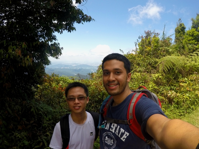
We passed by the “Last Water Point,” which branched out to the left and after a good 30 minute climb, we reached Rock Garden. It was a rocky outcrop with sweeping vistas of Genting Highlands and the mountain range over a similarly expansive valley. I dare say the scenery was as impressive as the one I encountered in Bukit Kutu.
Read Also: #TSDayOut – Bukit Kutu Expedition, Selangor


The Peak
Hikers always have the desire of accomplishment so we quickly made our way towards the mountain’s summit. It took us a good 40 minutes to reach the peak and it was hot and sunny at the top! We could see Klang Valley looking tiny like Legoland’s Miniland including the Bukit Tabur quartz ridge and Klang Gates Dam.
After a quick lunch, we went back down to Rock Garden and spent more time admiring the view. The whole valley glows a lush green as the sun evoked the trees and their leaves into life, while the deep blue sky became a freeway for the clouds to race each other into the yonder. It’s the perfect spot to lie down and daydream all day long.

Travel Tips:
- Gunung Bunga Buah is located near Goh Tong Jaya, Genting Highlands. The town is accessible via the KL – Karak Highway. Other than self-drive, you can also take a bus from the city or hire a cab.
- Gunung Bunga Buah is not managed by any government entity so please inform the police of your intentions of hiking the mountain as a safety measure. You can do so at Balai Polis Goh Tong Jaya (Tel: +03-61002222) .
- The hike takes about 3 hours 15 minutes one-way for us so make sure you bring ample water, snacks and a full meal for lunch. Both of us were prey to leeches in the morning – if you’re not feeling generous in wanting to donate some blood, make sure you wear long socks and a track suit.
- Credit must be given to Grace Abundant for providing a detailed run down of Gunung Bunga Buah’s trail from start to finish, including coordinates and photos. You can check out his experience here.
Nice!
It is gorgeous! Sadly, no one (either from the Selangor or Pahang governments) wants to manage it and turn it into a park.
True lah. A lot of place in Malaysia has potential but no initiative from government. Sad.
Reading this, now I feel like going!
This place looks gorgeous ! I had no idea about this place. I would love to go, but it looks a too uninhabited though, safety might be a concern for me 🙁
Yup. The mountain is not managed by any authority so it’s best if you could hike with a group of friends and notify the local police (nearest would be at Goh Tong Jaya) about your trip.